

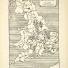
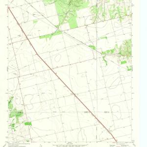
This is an original 1882 color photolithographed map of Edinburgh, the Firth of Forth and its surrounding areas of Scotland.
CONDITION
This 129+ year old Item is rated Near Mint. Light aging throughout. No natural defects. No surface rub. No tears. No water damage. Please note there is an original crease that extends down the center of this lithograph.
- Product Type: Orig. Photolithographed Map; Color
- Grade: Near Mint
- Dimensions: Approximately 12.5 x 9.25 inches; 32 x 23 cm
- Authentication: Serial-Numbered Certificate of Authenticity w/ Full Provenance
- Protection: Packaged in a custom archival sleeve with an acid-free black board (great for display, gift-giving, and preservation)
Keywords specific to this image: Untied Kingdom, Cartography, Lanark, Clackmannan, Devonside, Tullibody, Grangemouth, Haddington, East Salton, Liberton, Stirling, Damhead, Knock Hill, Anchtertool, Lochgelly, Thornton, Miltown, Kirktown
XGS6C82
Related products
Sale
Original price was: $49.99.$40.99Current price is: $40.99.
Sale
Original price was: $49.99.$36.99Current price is: $36.99.
Sale
Original price was: $49.99.$41.99Current price is: $41.99.
Sale
Original price was: $59.99.$47.99Current price is: $47.99.